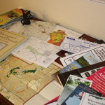
Even after repeated visits, I generally don’t feel that I have the sense of a place until I’ve studied it on a map. The right map can make you feel like you have an insider’s knowledge of a place. On a river, for example, you can find canoe launches, historic sites, dams and bridges, and the sources of feeder streams. You can see the shapes of the river’s course, and how it’s connected to the world around it.
County maps, canoe-route maps, regional maps, bike trails, birding trail maps, maps of state and county recreation lands…where can you find such a bounty of resources? “Bounty of Resources,” of course, is another name for the internet, and we’ll look at online maps in a future post. But for me, there’s no substitute for spreading out a map, Columbus-like, on a table to consider all the places I might explore.
So I’m always on the prowl for big, colorful, foldable maps. They’re available – often for free! – in a wide variety of places. Look for city, county, and other local maps in city halls, county administration buildings, and public libraries. These buildings often have brochure racks in the lobby or near the entryway, and they can be real treasure troves. Or imagine you’re a tourist, and visit the local chamber of commerce or visitors’ bureau.
Sometimes free maps turn up in surprising places, so keep your eyes open. In Nebraska, one of my best finds – a terrific map Kearney and the Platte River’s north channel – came from my auto mechanic. Here in Wisconsin, I’ve found maps at the hardware store, my local bank, and the grocery store.
The next time you see a free map, pick it up and take a look. You might just find something you didn’t even know you were looking for.

