Category Archives: Resources and Advice

Public Lands

Before I had the good luck – and the good sense – to marry a wildlife biologist, I never knew there were so many places where a person might take a walk.

Sure, I knew of a few state parks and faraway national parks. But in Lake Mills, if I wanted to be alone with the red-winged blackbirds, I settled for walking the gravel shoulder of Faville Road, where cars only occasionally zoomed by at 55 mph, and only one farm dog regularly chased me.

If I had looked at a county map, I might have seen several irregularly shaped green blobs within an easy drive of my home: Continue reading

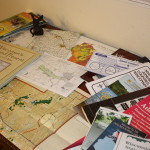
Advice from a Map-Hound

You can't have too many maps.

You can’t have too many maps.

Even after repeated visits, I generally don’t feel that I have the sense of a place until I’ve studied it on a map. The right map can make you feel like you have an insider’s knowledge of a place. On a river, for example, you can find canoe launches, historic sites, dams and bridges, and the sources of feeder streams. You can see the shapes of the river’s course, and how it’s connected to the world around it.

County maps, canoe-route maps, regional maps, bike trails, birding trail maps, maps of state and county recreation lands…where can you find such a bounty of resources? “Bounty of Resources,” of course, is another name for the internet, and we’ll look at online maps in a future post. But for me, there’s no substitute for spreading out a map, Columbus-like, on a table to consider all the places I might explore. Continue reading