Advice from a Map-Hound

You can't have too many maps.

You can’t have too many maps.

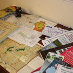
Even after repeated visits, I generally don’t feel that I have the sense of a place until I’ve studied it on a map. The right map can make you feel like you have an insider’s knowledge of a place. On a river, for example, you can find canoe launches, historic sites, dams and bridges, and the sources of feeder streams. You can see the shapes of the river’s course, and how it’s connected to the world around it.

County maps, canoe-route maps, regional maps, bike trails, birding trail maps, maps of state and county recreation lands…where can you find such a bounty of resources? “Bounty of Resources,” of course, is another name for the internet, and we’ll look at online maps in a future post. But for me, there’s no substitute for spreading out a map, Columbus-like, on a table to consider all the places I might explore. Continue reading

Whatever the Weather

When the thermometer read ten degrees a few days ago, I looked out the window and wondered what I had gotten myself into. I’d promised myself that, every day or two, I would take an exploratory walk…but that was when the temperature was thirty degrees warmer.

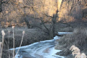
Ice on the Baraboo 123014

Ice forms on the Baraboo River.

Stuffing myself into my wool layers, I considered the likelihood that I would see little wildlife. Birds and small mammals would be huddled out of sight, trying to stay warm. There wasn’t even any snow on the ground to show animal tracks. So be it, I thought. I’ll go out and watch the river freeze.

Three miles from home, where Nutmeg Road crosses the Baraboo River, I pulled my hat down Continue reading

Meet the Rivers

My own quest will begin on the Baraboo River. The Baraboo is near my house, so I can visit it frequently and observe it closely at all times of the day and throughout the year. The Baraboo’s headwaters are just a few miles from Elroy; from here it flows generally southeast through the Driftless Area — an ancient landscape carved by running water — to its confluence with the Wisconsin River, about a dozen miles downstream from Aldo Leopold’s shack. Continue reading

Deciding Where to Walk

How do you begin to achieve deep knowledge of the landscape you inhabit? The naturalist’s first step, I think, is to take a walk. And then another walk…and then another.

Roam around until you find a place that captures your imagination.

Roam around until you find a place that captures your imagination.

Identify a place that you can really study. Perhaps you have a favorite spot already – a nearby wetland or meadow, or your own backyard. In cities or suburbs, a park can be a good choice.

Or maybe you’re like me – temperamentally disinclined to focus. I was one of those voracious kids who wanted to know everything about everyplace…and in some ways I never grew up. Here’s a method I found useful in choosing, at least provisionally, a place to study: Roam at will. Out the back door, up the road, over the hill. Visit lots of places, to see what you can see. Continue reading

A Naturalist Walks Home

In 2004, I stood for the first time beside Nebraska’s Platte River and wondered why maps show a thick blue line to represent such a feeble a stream. The Platte was a mystery to me in this and countless other regards. Without really planning to do so, I made a quest of exploring the Platte and learning its ways. In six years of walking, watching, and reading, I became attached to a place where, as a temporary transplant, I was sure I’d never belong.

Four years ago, I was transplanted again – back to Wisconsin, the state in which I grew up. I live in Elroy, amid the spectacular hills of the Driftless Region. A quarter-mile downhill from my back door, a new river flows through my life: the Baraboo is so close that in the spring, I can throw open the windows and hear frogs singing in the bottomlands. Continue reading