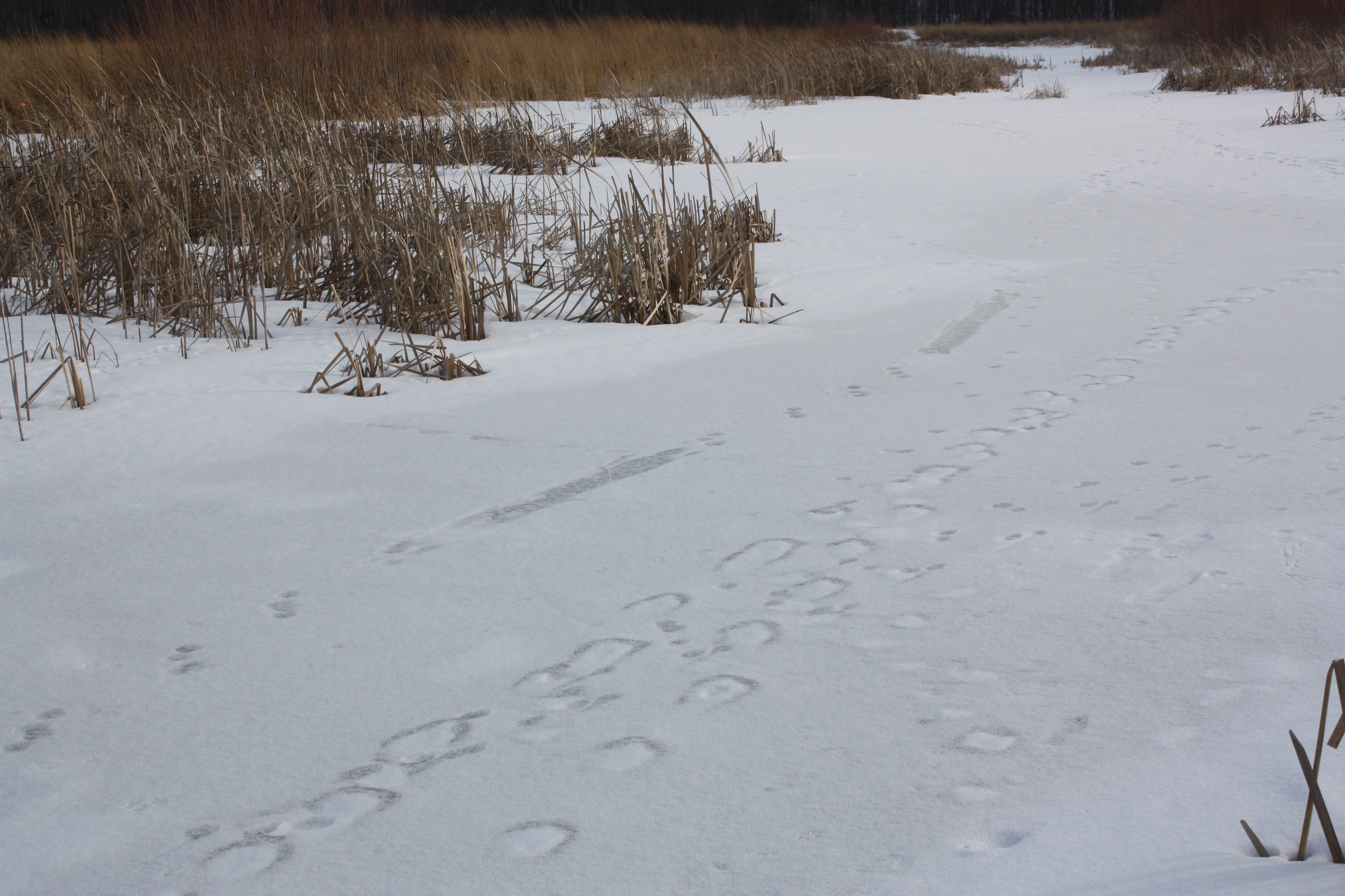
Otter tracks on the ice.
In Sauk County, where Highway 33 follows the Baraboo River down a gentle incline toward the Wisconsin River, there’s a large wetland that I’ve often admired, especially on fine days when the water glistens in the sun. But whenever I’m driving down Highway 33, I’m on my way to…someplace. So I never stop.
Today, when the temperature rose toward thirty degrees and the sun peeked out from behind the clouds, I said to my husband, Mark, “Let’s take a walk.”
This was a scouting trip. I didn’t know if we would be able to walk very far, or if we would see anything of interest. I did know that the place was named Fairfield Marsh, and that it was a Waterfowl Production Area. WPAs are federal lands, managed by the U.S. Fish and Wildlife Service as part of the National Wildlife Refuge System. This particular WPA had a small parking area and a large kiosk that confirmed what I had hoped – the public land stretched from the road to the river’s edge. In between were several wetlands, which might still be covered with ice.
The snow, having briefly thawed and re-frozen last week, was hard and crunchy; to walk, I had to lift each foot and stomp down. It took some effort, but I marched along happily, listening to the crows calling and wind rushing through the dry grasses, while Mark ranged far ahead – on our walks “together” we seldom stay together.
Remnants of last year’s vegetation told me what I can hope to find when I visit later this year: Indian grass, prairie cord grass, compass plants. And as I walked across the ice – easily crossing a wetland that might be impassable come spring – I passed muskrat houses fashioned from heaped-up cattails. Better yet, we found signs of a creature whose presence we might not have detected in the summer: an otter’s footprints ran down the ice, punctuated by its characteristic belly slides.

Inspecting the draining ditch.
Like many public wetlands in the Midwest, Fairfield Marsh is “restored,” meaning that it was previously drained and farmed. We found the evidence near the river: a deep drainage ditch and an opening in the bank. Marked showed me where the ditch had been “plugged” as part of the restoration, so that the water would stay on the land. Still, I have questions: What did it take to re-shape those wetlands and restore the native plants? How long did the restoration take, or is it still evolving?
I’ll look for the answers and visit Fairfield Marsh again. In time, when I drive down Highway 33, instead of musing, “Hmmm, I should stop there someday,” I’ll be able to smile and think, “I know that place.”